Tuesday, October 25th
Overview: Everybody loves a map. But what kinds of inquiry do digital maps foster? When compared with sequential or linear forms of reading and interpretation, what does a map do persuasively? What does it do too persuasively? To what effects on our perceptions of geographical space? How can a map simultaneously represent the local and the global, or the street view and the bird’s eye view? Is a map ever exact? High fidelity? And once again: how might a map be integrated (if at all) into your projects, especially when you frame your work as humanities research?
Reading Due: (1) “Mapping Novels with Google Earth” by Erin Sells, and (2) “All Things Google: Google Maps Labs” by Brian Croxall
Suggested Reading: (1) the “Spatial Humanities” project at the University of Virginia’s Scholars’ Lab, (2) “On Exactitude in Science” by Jorge Luis Borges, (3) OpenStreetMap, (4) ArcGIS, (5) “Critical GIS Reading List” by Matthew W. Wilson, and (6) The Historical GIS Research Network
Suggested Viewing: “West Wing – Why are we changing maps?”
and “GIS Workshop 2011 at Ball State University”
Assignment Due: Like last week, start re-presenting your evidence, this time through Google Earth. Map what evidence you can, using Sells’s and Croxall’s pieces as launching pads. During the lab session, we’ll again fine-tune and share your work.
Outcomes: Map your evidence using Google Earth. Circulate your maps for feedback and revise accordingly. Identify what evidence is missing from your map and how it might be added. Determine whether a map is appropriate for your project. Optional: consider other ways (i.e., other than geographical) of mapping your evidence.
Friday, October 28th
Overview: What is “distant reading” anyway, and how does it relate to maps? To close reading? To ways of using computers to read texts? And what might be some objections (persuasive or not) to this form of interpretation?
Reading Due: “Conjectures on World Literature” by Franco Moretti
Suggested Reading: (1) Graphs, Maps, Trees by Franco Moretti (we’ll look at portions of this book during class), (2) Atlas of the European Novel by Franco Moretti, (3) “Digital Maps Are Giving Scholars the Historical Lay of the Land” by Patricia Cohen, (4) “Distant Reading Minds” by Steven Berlin Johnson, and (5) “Well Read: Humanities Computing and the Horizons of the New(-ish) Literary Macrocriticism” by Jeff Rogers
Assignment Due: Comment on Blog Entry #4 (question circulated during class on Tuesday, October 25th). Also bring a specific question about Moretti’s article to class.
Outcomes: Determine how distant reading differs from and intersects with close reading. Articulate a process by which one would go about reading a corpus or an archive from a distance. Identify the appeal of seeing things from above.
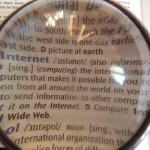
Index image care of Wikipedia Commons.